
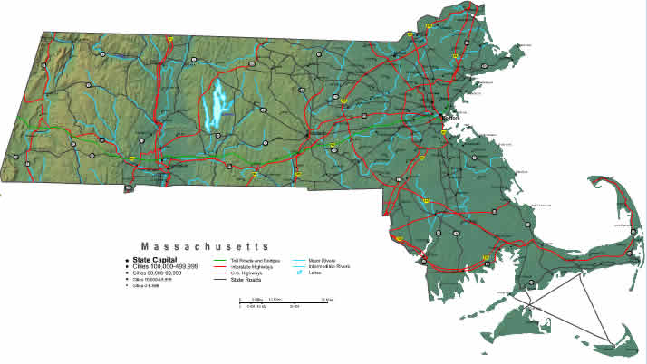
On Sunday I poked around Quabbin Reservoir, which, for those of you from other parts of the world, is one of the largest man-made water supplies in the country, supplying water for the Boston vicinity. Take a look at a map of Massachusetts and the big blue thing in the center of the map is the Quabbin. It was built back in the 1930s, and the residents of four towns were relocated to higher ground, buildings were moved and demolished, and graves were dug up and moved to the Quabbin Park cemetery. Access is pretty limited, and the immediate surrounding towns are mostly small and sparsely populated. There are myths about being able to look down into the water and see buildings underneath, but the official word is that that's not true. I ran across a great booklist of fictional and true books about "drowned towns." Check the list out here: http://librarybooklists.org/mybooklists/drownedtowns.htm
So anyway, here are some views of the Quabbin. The weather was gorgeous, as you will see.


No comments:
Post a Comment